It really is the journey, not just the destination.
There are 2 major ways to navigate as we travel. The main choice or conflict is map vs GPS. There are alternatives, like being on a tour or “dead reckoning”, but I will rule those out for now.
GPS
By GPS, I mean, of course, a Global Positioning System app on our phone or in our car. What an astonishingly useful technology. Who would have thought not that long ago that we would have such precise navigation available to anyone, anywhere, right in our hand?
GPS is an important supporting technology that aids our great transportation system.
When we are going to an unfamiliar place, who hasn’t entered the destination in their device and welcomed the detailed, turn by turn directions? Or been annoyed by the nagging “Proceed to the route” admonition when we veer off for some reason. Even for familiar places, we often use the app, because the magic of the internet allows it to provide real time route updates to take us around congestion or road construction. Amazing.
I would say that most of us expect this level of service now. These wonderful apps will take us by the best route direct to our destination with little decision making or navigation required by us.
But that can be the problem.
 ©Ed Schlotzhauer
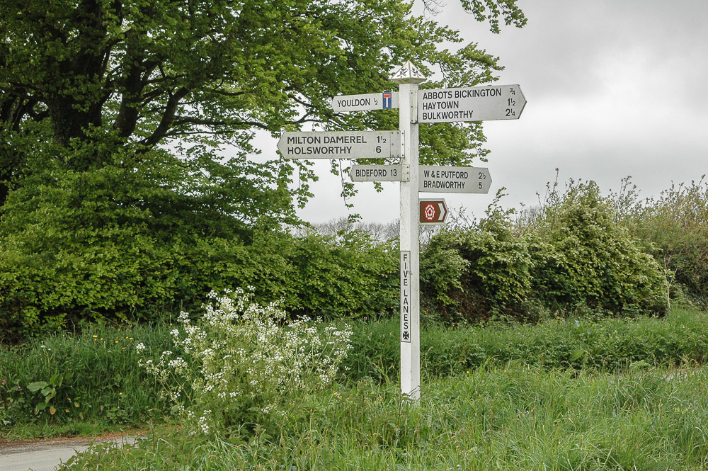
Physical map
Do you remember maps? Like that image at the top of this article? You know, those folded paper things that always seem to tear when we try to open them. And spread out to cover everything around us.
Some of you may never have held an actual map.
What is it? A map is a representation of an area on a 2-dimensional print. There are limitless kinds of maps, but I am only talking about geographic maps. Usually, a Mercator Projection. Sorry. TMI, but I like detail.
A typical map shows cities and towns, roads, lakes, rivers, and oceans. Some have topographic lines to show elevation and some use shading to give an idea of elevations. It is not unusual for them to show train tracks, parks, monuments, military installations, and other features of interest.
The area the map can show is a function of the amount of detail wanted and the allowable size of the map. To “zoom in” and see more detail means it cannot cover as much area.
In a large place like the United States, a fairly detailed map may cover a state. In other places, it might show a whole country. We can also get very detailed topographic maps that cover only a few miles in great detail.
So, a map shows us a top-down view of what is there, but it is up to us to interpret and use the information and navigate to where we want to go.
That’s more work. Why would anyone choose that over a GPS app? That is where it gets interesting to me.
 ©Ed Schlotzhauer
What does it say about us?
Yes, indeed, why ever use a map? I think it has to do with our goals, our personality, and, if we are photographers, how we work and think.
A GPS app will take us to a destination with little thought or planning on our part. We do not have to pay much attention to where we are or what we are going through.
It does its job efficiently. It is a faithful robot that does not distract us with sightseeing suggestions or side trip possibilities.
Get there. Check it off. The destination is the goal.
A map, though, can be a storybook of possibilities. It is a tool for our curiosity. Look, there is a waterfall just a few miles away. And that small, twisty road through the National Forest looks a lot more interesting than this Interstate highway. I wonder what that is over there. Oh, there’s where that town is. I’ve wanted to visit it. It’s just a little way off this route. That is worth a look. Maybe I will even stay the night there.
A map shows the layout of everything that is around. It is kind of like browsing a buffet. I can pick a little of this, some of that, sample this other that I have wanted to try. It doesn’t try to guide us along any path. That is up to us.
There are often endless possibilities, depending on what I am interested in and how I want to use my time. I select where to go and how to get there. I know that, for me, my interests are usually in the small towns and back country rather than big cities and major highways. If I have the choice, that is what I pick.
 ©Ed Schlotzhauer
Use the right tool
GPS and maps are both just tools. Each has strengths and weaknesses. It is up to us to choose the best tool to use for the need at hand.
If the destination is the goal and time is tight, GPS will take us there directly and give precise directions. But if we have the luxury of choosing our own path on our own schedule, maps let us see an overview of the area. It lays out the information visually for us to see and to decide and choose. I don’t think I have ever discovered anything great that I wanted to photograph just following GPS directions.
Map vs GPS. They are not actually in competition. I use both. For example, I recently got back from a 5000 mile driving trip. I used GPS to navigate to specific destinations, like to a hotel, once I got close. Otherwise, I used maps to let my imagination wander. And I did wander. Through swamps, finding a hidden winery, along back roads in the Ozarks, to some charming places I knew nothing about along the gulf coast. None of these were things my GPS would have suggested. I would have hated to miss any of them.
It is said that it’s the journey, not the destination. I try to live that way. I’m partial to maps. GPS is excellent for getting to a destination. Maps, though help me discover a more interesting journey.
 ©Ed Schlotzhauer
Try maps again
I encourage you to try maps again. When I see a detailed map like the section at the top, my pulse quickens, and I start getting excited. Sitting in a hotel room at night with a high quality, detailed map spread out on the table, visualizing possibilities for the journey ahead can be like reading a great story. But in this case, we are writing our own story.
After all, we are creatives. We do that.
To finish the moment, to find the journey’s end in every step of the road, to live the greatest number of good hours, is wisdom.
Ralph Waldo Emerson
Getting maps
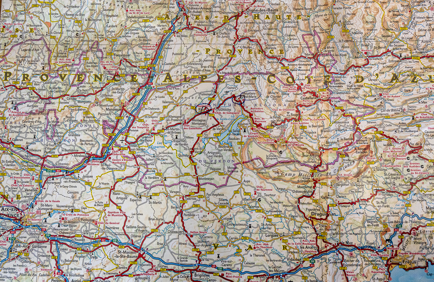
The image at the head of this article is a very small section of a National Geographic map of southern France. This covers about 70 miles by 50 miles. I have been to this area, and I used this very map for navigation. NatGeo has become my preferred map source.
The best map providers I know of are National Geographic and Michelin. They have an amazing catalog of detailed maps. Some are printed on a plastic coated, tear proof paper, like the France map above.
If you are in the USA and are a AAA member, you can get maps from them for free. Just go to your nearest AAA office. These are good maps, I use them, but they tear easily. But then, free…
These map provider suggestions are for your information. I do not receive any compensation.
About these images
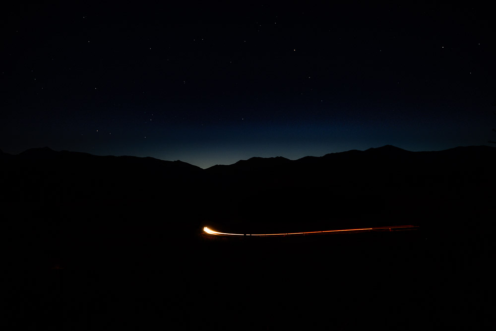
All of these images (other than the map image, of course) are places that had to be discovered by exploring while using maps. None of these could easily have been navigated to by GPS unless someone gave you a precise location. One of them is a location on that map of France.
Try maps. They may change how you travel and photograph.
 ©Ed Schlotzhauer
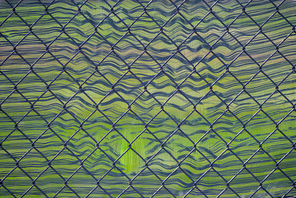 ©Ed Schlotzhauer
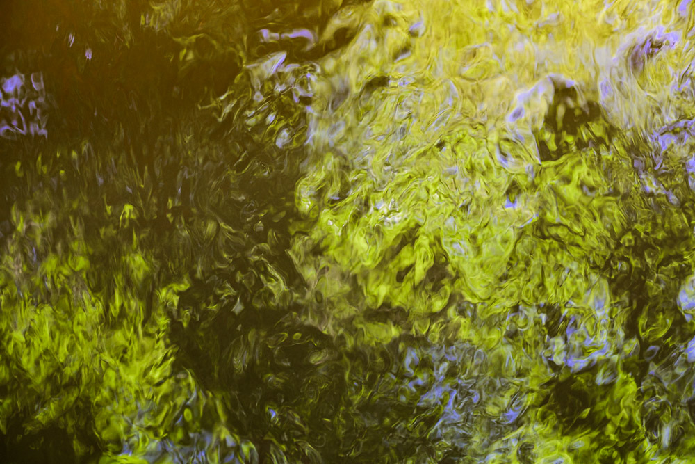 ©Ed Schlotzhauer
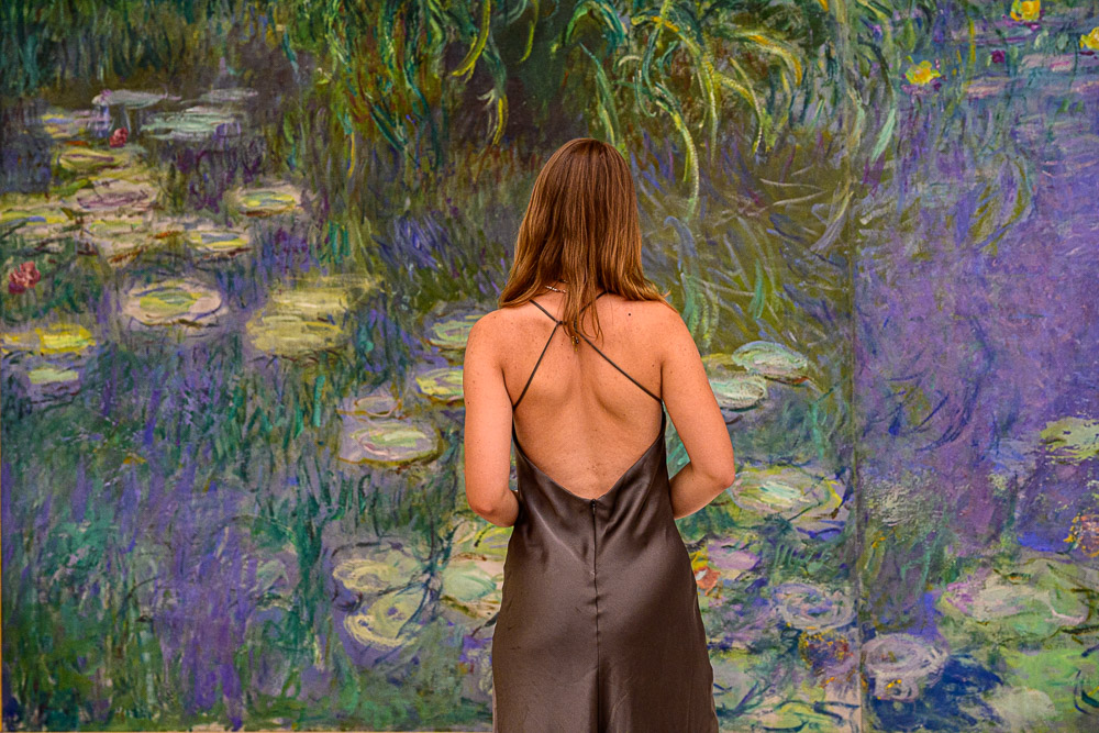
 Tourists queue in front of the Louvre in Paris in 2017. The museum shut down for one day earlier this year after employees walked out due to overcrowding (Credit: Getty Images)
 ©Ed Schlotzhauer
 ©Ed Schlotzhauer
 ©Ed Schlotzhauer